Industry Pain Points

Rugged
Terrain

Steep reservoir areas defy traditional high-precision topographic mapping methods.

Complex
Structures

Dams and gates require manual modeling that often misses critical details.

Outdated
Records

Paper-based archives prevent real-time engineering data synchronization.

Emergency
Coordination

Flood responses lack live geospatial support for rapid decisions.

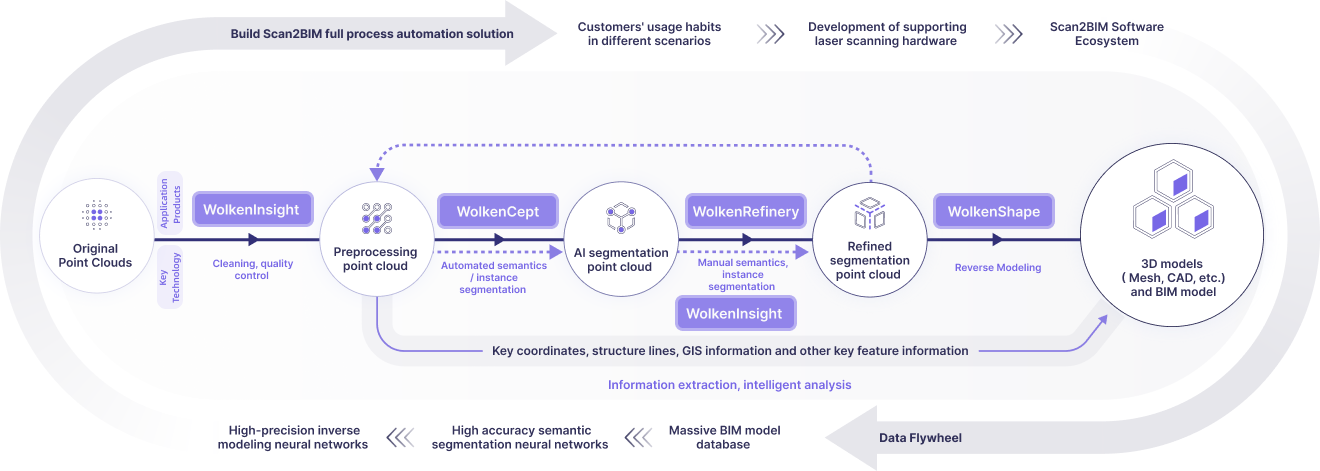
Product Process

Deeply aligned with user needs to build an optimized closed-loop experience

Business Values

Innovative spatial data production methods balancing precision, cost and experience

Cost Savings

Eliminating repeat surveys and rework
Reducing downtime and operational expenses

Efficiency Boost

Single scan generates full-element models
Accelerating survey-to-maintenance workflows

Precision Decision-making

Integrating digital twin of terrain and infrastructure
Enabling data-driven flood control and investment decisions

Contact Us

Share your vision with us
— we’ll bring the technology to make it real.

Thank you for reaching out!
Our team will be in touch shortly.
Tell us about your project so we can tailor the best solution for you.

Fill Out Now

© 2025 WolkenVision AG.