Industry Pain Points

Long-Distance
Monitoring

Manual inspections and fixed sensors fail to cover remote areas cost-effectively.

Complex
Modeling

Multi-layer structures defy 2D documentation, making 3D modeling expensive.

Hidden
Risks

Some deformations evade detection, causing delayed warnings.

Subjective
Maintenance

Visual inspections introduce bias; ungeoreferenced data prevents decay analysis.

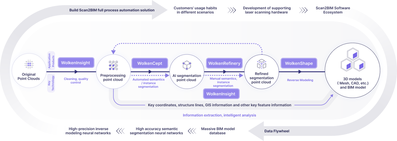
Product Process

Deeply aligned with user needs, building an optimized experience closed-loop

Business Values

Innovative spatial data production methods balancing accuracy, cost and experience

Efficient Modeling

Rapid modeling from single scan
Replacing traditional surveys, boosting design efficiency

Cost Savings

Reducing survey and rework costs
Optimizing lifecycle resource utilization

Next-Gen Enablement

Supporting smart highways and autonomous driving
With core mapping and data infrastructure

Contact Us

Share your vision with us
— we’ll bring the technology to make it real.

Thank you for reaching out!
Our team will be in touch shortly.
Tell us about your project so we can tailor the best solution for you.

Fill Out Now

© 2025 WolkenVision AG.