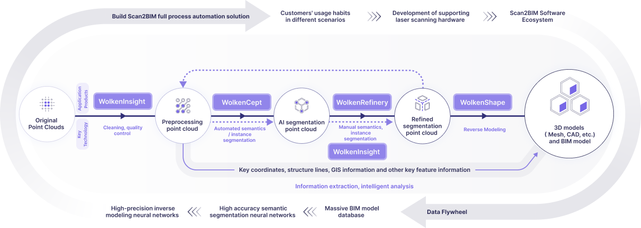
Industry Pain Points

Outdated
Basemaps

City maps lag behind rapid spatial changes due to slow traditional surveying.

Unverifiable
Implementation

Zoning lacks visual verification methods between plans and actual construction.

Unanticipated
Conflicts

Infrastructure clashes escape detection during planning phases.

Unenforceable Zoning

Missing 3D modeling tools prevent reliable construction-outcome evaluations.

Product Process

Deeply aligned with user needs to build an optimized closed-loop experience

Business Values

Innovative spatial data production methods balancing precision, cost and experience

Efficiency Improvement

Quickly generating current 3D base maps
Shortening data update cycles to ensure planning timeliness and accuracy

Spatial Restoration

Constructing three-dimensional urban spatial models
Comprehensively representing true forms of buildings, roads, terrain, and other features

Multi-Plan Integration

Breaking down planning data barriers across departments
Enhancing urban multi-plan unification and collaborative decision-making

Contact Us

Share your vision with us
— we’ll bring the technology to make it real.

Thank you for reaching out!
Our team will be in touch shortly.
Tell us about your project so we can tailor the best solution for you.

Fill Out Now

© 2025 WolkenVision AG.